Introduction
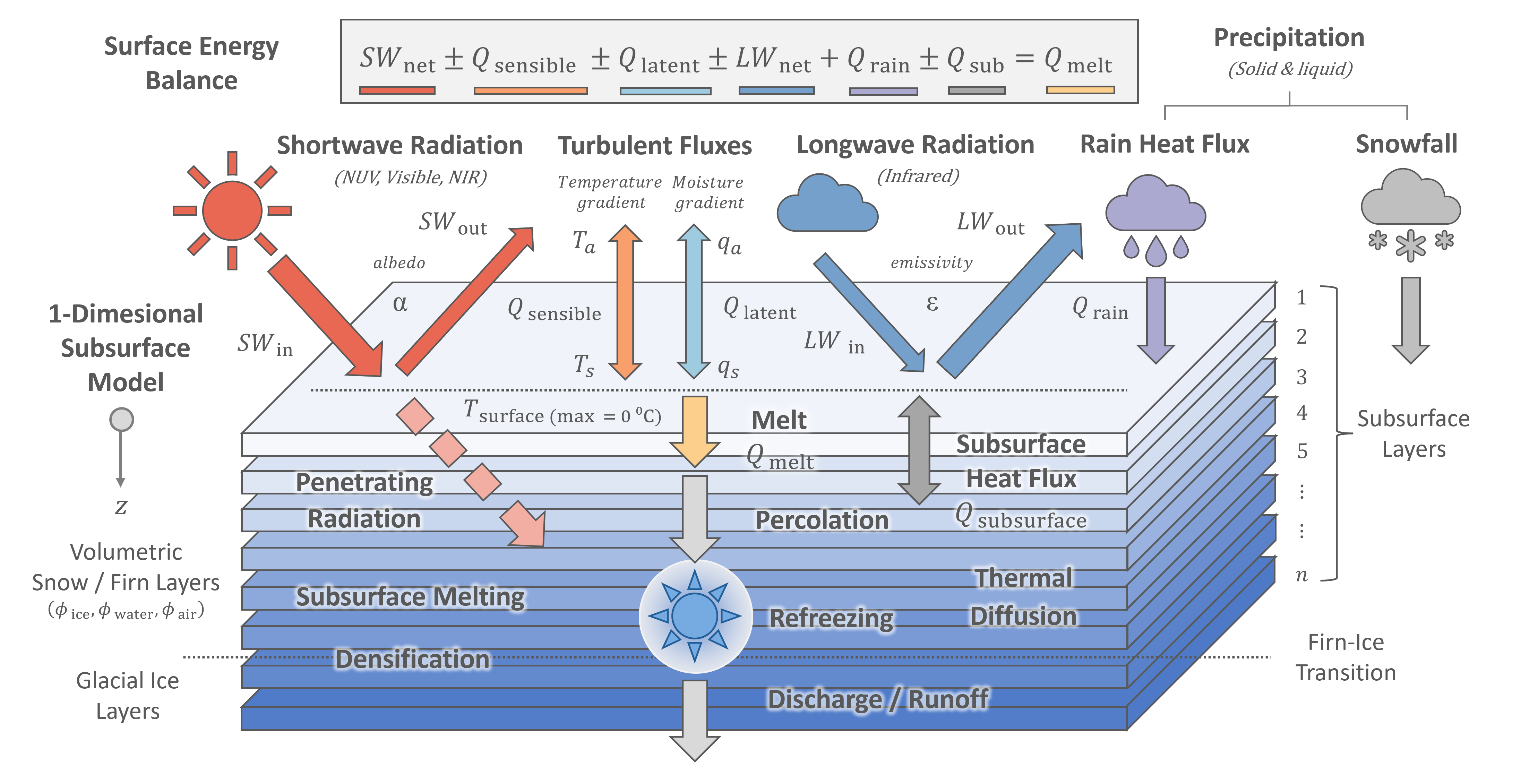
The FRICOSIPY model combines a surface energy balance with a multi-layer subsurface model. For each simulation timestep, first the surface temperature of an infinitesimal skin-layer is determined by evaluating the surface energy fluxes – these are either phyically-derived or parameterised from the input meteorological and topographic data. Subsequently, the intrinsic properties of firn layers are updated according to subsurface physical process such as meltwater percolation & refreezing, thermal diffusion and dry densification. The subsurface grid is discretised according to a Lagrangian scheme with layers translating vertically according to mass exchange at the surface.
The model is 1-dimensional in space; each grid cell (or spatial node) is simulated independently through time, with no lateral transfer of heat or mass between adjacent nodes. However, it incorporates certain quasi-3-D processes, most notably the topographic shading of solar irradiance, which depends on the elevation of the surrounding terrain. The input meteorological data is also interpolated across the spatial domain from a user-defined reference point according to topographic factors.
FRICOSIPY is best characterised as a mid-complexity glacier model. It represents physical processes more comprehensively than basic temperature-index models (eg. Hock, 1999 , Huss & Hock, 2015) yet is less computationally expensive than more complex 3-dimensional, thermomechanically-coupled, Stokes ice flow models. However, it does still require high resolution meteorological data and model performance is greatly influenced by the quality of this input data.
The following sections explain how the model functions in detail, outlining the parameterisations and key physical processes simulated in the model.